
 العربية
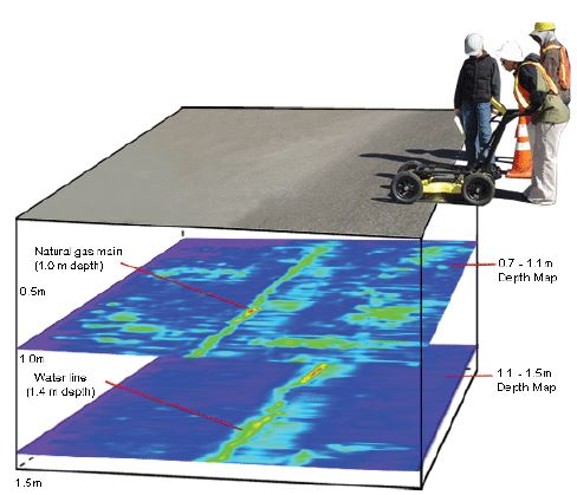
GPR Mapping
GPR is used to detect and map subsurface features such as utilities, voids, and geological structures without excavation. A drone GPR can enable data collection in remote, hazardous, and inaccessible areas.

GPR is used to detect and map subsurface features such as utilities, voids, and geological structures without excavation. A drone GPR can enable data collection in remote, hazardous, and inaccessible areas.